Professional geophysical investigation using Electrical Resistivity Survey and Vertical Electrical Sounding (VES) for groundwater exploration, aquifer delineation, and subsurface characterization.
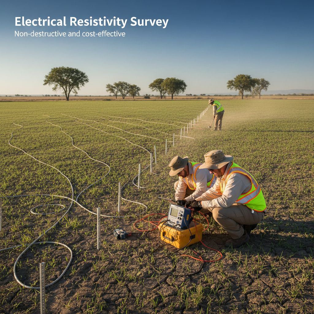
Electrical Resistivity Survey is a geophysical investigation method used to determine subsurface geological conditions by measuring the electrical resistivity of soil and rock layers. Vertical Electrical Sounding (VES) is carried out to determine the vertical variation of resistivity with depth, helping identify subsurface lithological succession, weathered zones, fractured formations, and groundwater-bearing aquifers.
Delineation of groundwater potential zones and aquifer characterization for sustainable groundwater development.
Identification of depth to bedrock, overburden thickness, and subsurface lithology mapping using resistivity analysis.
Selection of suitable sites for groundwater abstraction structures based on scientific geophysical data.
Non-destructive and cost-effective survey conducted using standard electrode configurations as per CGWB practices.
Interactive demonstration — move the slider to widen the electrode spacing and sound deeper into the earth.
Schematic of a vertical electrical sounding (VES) using a Schlumberger array. Amber arcs are current flow lines between electrodes A and B; dashed blue curves are equipotential surfaces — the potential electrodes M and N draw practically no current, they only measure the voltage difference ΔV between the equipotentials they sit on (ρa = K·ΔV/I). Values are illustrative; real surveys measure dozens of spacings and invert the curve numerically.
VES is carried out to determine the vertical variation of resistivity with depth using standard electrode configurations (Schlumberger / Wenner array) as per prevailing practices of CGWB and State Ground Water Departments. Interpretation is based on resistivity curve analysis and geoelectrical modeling.
Comprehensive groundwater potential assessment through systematic resistivity surveys to identify weathered zones, fractured formations, and groundwater-bearing aquifers. Our surveys provide reliable data for borewell and tube-well site selection.
Advanced data processing including curve matching, inversion techniques, and geoelectrical modeling to produce accurate subsurface layer models with depth-wise resistivity and thickness information.
Electrical resistivity surveys for geological and geotechnical site characterization, providing essential subsurface information for engineering studies, environmental assessments, and infrastructure projects.
Initial site reconnaissance and finalization of VES locations based on project objectives and geological understanding of the area.
Systematic field data collection using Electrical Resistivity Meter with appropriate electrode configurations (Schlumberger / Wenner array).
Processing of apparent resistivity data through curve matching, inversion techniques, and geoelectrical modeling for accurate results.
Detailed interpretation of geoelectrical data to identify subsurface layers, aquifer zones, and lithological correlations.
Comprehensive reporting with interpreted subsurface models, groundwater potential assessment, and recommendations for borewell locations.
We utilize calibrated geophysical equipment and standard methodologies as per CGWB and State Ground Water Department practices to ensure accurate, reliable results for all resistivity survey projects.
Assessment of groundwater regime within forest land, evaluation of impact on subsurface water resources, and supportive data for Hydrogeological Study section of FC reports.
Identification of aquifers intersecting mining horizons, assessment of groundwater inflow conditions, and support for Mine Water Management Plan and EIA/EMP.
Selection of sites for borewells and tube-wells, assessment of groundwater availability for irrigation, and input data for DPRs and feasibility studies.
Geological and geotechnical site investigations for foundation design, subsurface condition assessment, and engineering studies.
Environmental and engineering studies including baseline data for Environmental Impact Assessment and subsurface contamination investigations.
Cost-effective subsurface investigation suitable for both rural and urban projects, supporting sustainable groundwater development planning.
Non-destructive and environmentally safe method that causes no damage to the survey site or surrounding environment.
Significantly more cost-effective compared to drilling investigations while providing accurate depth estimation of subsurface layers.
Surveys conducted as per prevailing practices of CGWB and State Ground Water Departments ensuring compliance and reliability.
Experienced geophysicists and geologists providing accurate interpretation and actionable recommendations for your projects.
Contact our expert geophysical team today to discuss your project requirements and receive a detailed proposal.